Introduction#
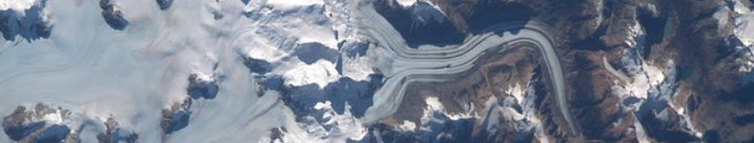
Credit: NASA / Woody Hoburg
What is the RGI?#
The Randolph Glacier Inventory (RGI) is a globally complete inventory of glacier outlines (excluding the ice sheets in Greenland and Antarctica). It is a subset of the database compiled by the Global Land Ice Measurements from Space (GLIMS) initiative. While GLIMS is a multi-temporal database with an extensive set of attributes, the RGI is intended to be a snapshot of the world’s glaciers at a specific target date, which in RGI 7.0 and all previous versions has been set as close as possible to the year 2000 (although in fact its range of dates can still be substantial in some regions). The RGI includes outlines of all glaciers larger than 0.01 km², which is the recommended minimum of the World Glacier Inventory.
The RGI was not designed for the measurement of glacier-by-glacier rates of area change, for which the greatest possible accuracy in dating, delineation and georeferencing is essential. While many RGI outlines meet these requirements, the primary focus of the RGI is on achieving global coverage, consistency, and proximity in a specific year. The strength of the RGI lies in its ability to handle large numbers of glaciers simultaneously. This allows, for example, for the estimation of glacier volumes and rates of elevation change at regional and global scales, as well as the simulation of cryospheric responses to climatic forcing.
Who develops and hosts the RGI?#
The RGI has been developed in an international community-driven effort of glaciologists starting in 2010. The inventory was named after “Randolph”, a town in New Hampshire, USA, where the team met for one of their meetings [Pfeffer et al., 2014]. In 2014 development of the RGI became the responsibility of the Working Group on the Randolph Glacier Inventory and Infrastructure for Glacier Monitoring, which operated under the International Association of Cryospheric Sciences (IACS). In 2019, a new Working Group was established to build upon the previous achievements and further expand its objectives: the IACS Working Group on the Randolph Glacier Inventory (RGI) and its role in future glacier monitoring and GLIMS.
The RGI datasets are listed on glims.org, and the RGI files can be downloaded through the data portal at the National Snow and Ice Data Center (NSIDC), which is the host for GLIMS.
Data distribution policy#

The RGI may be used freely under the Creative Commons Attribution 4.0 International License with due acknowledgement (by proper referencing, see below). Where appropriate (for example for regional studies), users are invited to cite the analysts who provided the RGI outlines. See Data description of RGI 7.0 for more details about how to retrieve this information from the RGI, and Regional revisions in RGI 7.0 for a region-by-region data description.
Dataset reference#
The RGI 7.0 dataset should be cited as:
RGI 7.0 Consortium, 2023. Randolph Glacier Inventory - A Dataset of Global Glacier Outlines, Version 7.0. Boulder, Colorado USA. NSIDC: National Snow and Ice Data Center. doi:10.5067/f6jmovy5navz. Online access: https://doi.org/10.5067/f6jmovy5navz
We request all users to use this reference in publications that use RGI 7.0 data. All names of the consortium are listed in the RGI 7.0 Consortium.
This user guide should be cited as:
Maussion, F., Hock, R., Paul, F., Raup, B., Rastner, P., Zemp, M, Andreassen, L., Barr, I., Bolch, T., Kochtitzky, W., McNabb, R. and Tielidze, L: The Randolph Glacier Inventory version 7.0 User guide v1.0, 2023. doi:10.5281/zenodo.8362857. Online access: https://doi.org/10.5281/zenodo.8362857.
This reference should be used when referring to specific details that are not covered elsewhere, for example: “The aspect sector from glacier X is computed from a 100 m UTM grid (Maussion et al., 2023).”
Peer-reviewed publication:
A detailed scientific description of the RGI version 7 is in preparation and expected to be published in 2024.
Earlier versions
The RGI 6.0 data set is referenced as: RGI Consortium, 2017. Randolph Glacier Inventory - A Dataset of Global Glacier Outlines, Version 6. Boulder, Colorado USA. NSIDC: National Snow and Ice Data Center. doi: https://doi.org/10.7265/4m1f-gd79.
Earlier versions of the user guide (then called Technical Report) are referenced as: “RGI Consortium (2017), Randolph Glacier Inventory – A Dataset of Global Glacier Outlines: Version 6.0. GLIMS Technical Report” and earlier versions as “Arendt et al.” (various dates).
A detailed scientific description of the RGI version 3.2 is given by Pfeffer et al. [2014].
The RGI logo and its variants can be downloaded here.
How to name the RGI versions?#
We recommend explicitly stating the version number when referring to a specific version rather than the RGI in general. We recommend the following formats:
RGI version 7.0
RGI 7.0 (note the empty space)
RGI v7.0
Data sources#
All outlines for RGI 7.0 are derived from the GLIMS database and comply with the GLIMS license agreement. Many new outlines used in RGI version 7.0 were submitted by the community to GLIMS in response to calls for data on the GLIMS and Cryolist e-mail listservers (2020-05-13). See Appendix 2: Full list of contributors for a list of RGI 7.0 contributors.
Since GLIMS was globally incomplete, earlier RGI versions combined outlines from GLIMS with outlines from other sources, the latter including outlines specifically generated for the purpose of the RGI. These outlines had not yet been submitted to GLIMS, did not meet GLIMS standards, or did not comply with the GLIMS license agreement. GLIMS achieved global coverage by incorporating the missing glacier outlines from RGI version 6.0 and a few other sources. Starting from RGI version 7.0, the workflow has been revised and optimized. The RGI is now entirely derived from the GLIMS database, which means that the RGI 7.0 glacier outlines are a subset of the GLIMS database as of its download date (for RGI 7.0 the cutoff date was May 24th, 2023). The RGI however extends the GLIMS outlines by providing additional products and attributes based on additional algorithms and data sources described in Data description of RGI 7.0.
RGI source code#
All code used to generate RGI 7.0 is available on the GLIMS-RGI Github organization:
GLIMS-RGI/rgi7_scripts: code and scripts generating the RGI out of GLIMS
GLIMS-RGI/rgi_user_guide: this user guide.
Version history#
Version 7.0, released in September 2023, comes with major outline quality improvements in nearly all RGI regions. In addition new products are available including, for example, outlines of glacier complexes and glacier centerlines. Furthermore, the RGI production has been entirely redesigned to use GLIMS as the sole source of data. The file generation process is now largely automated, extracting from GLIMS the outlines closest to the target date while also relying on expert judgment for the exact choice of available outlines. Open source scripts are used for all dataset creation steps. The file naming convention and attributes have changed substantially, requiring users of previous versions to adapt their data analysis workflow (see General revisions in RGI 7.0 for more details).
Version 6.0, released in July 2017, has improved coverage of the conterminous US (regions 02-05 and 02-06), Scandinavia (region 08) and Iran (region 12-2). In Scandinavia several hundred smaller glaciers have been added and most glaciers now have exact dates. The flag attributes RGIFlag and GlacType were reorganized. Surging codes have been added from Sevestre and Benn (2015).
Version 5.0, released in July 2015, had new coverage of most of Asia (RGI regions 10, 13, 14 and 15), with some improved outlines elsewhere. Linkages to the Fluctuations of Glaciers database of the World Glacier Monitoring Service were provided for some glaciers with mass-balance measurements.
Version 4.0 was released in December 2014. The most significant enhancement was the addition of topographic and hypsometric attributes for nearly all glaciers. These new attributes are described in detail below. Many glacier outlines were unchanged in version 4.0, but many more glaciers were assigned dates or date ranges, some names were added or corrected, and the inventory of Alaska was new. Remaining glacier complexes in Bolivia were subdivided, and nominal glaciers were added to correct omissions in the Greater Caucasus. A global grid of glacierized area with 0.5-degree resolution was added.
Version 3.0 was an interim release representing the RGI as of 7 April 2013. It was the basis for the work of Gardner et al. [2013]. The main improvements included identification of all tidewater basins, and separation of glacier complexes into glaciers in nearly all regions. Version 3.2, released in August 2013, included additional separation of glacier complexes into glaciers, and repairs of some geometry errors. It is the basis for the scientific description and analysis of the RGI by Pfeffer et al. [2014].
Version 2.0 also added shapefiles for its first-order and second-order regions.
Version 1.0 of the RGI was released in February 2012. It included a considerable number of unsubdivided ice bodies, which we refer to as glacier complexes, and a considerable number of nominal glaciers, which are glaciers for which only a location and an area are known; they are represented by circles of the appropriate area at the given location. An unofficial update of version 1.0 was provided in April 2012 to replace several regions that had topology errors and repeated polygons. Version 2.0, released in June 2012, eliminated a number of flaws and provided a uniform set of attributes for each glacier. Several outlines were improved, and a number of outlines were added in previously omitted regions.
Future updates#
For the RGI to maintain its fundamental role as reference dataset for the community and policy relevant efforts such as the IPCC, we anticipate future minor updates (e.g. v7.1) to represent changes only in the glacier attributes or data format, not in the outlines themselves (unless exceptional circumstances). Future updates to the RGI will be necessary, and will be the purpose of a subsequent working group to be announced on CRYOLIST at a later date.
The RGI 7.0 Consortium#
The 109 members of the RGI 7.0 Consortium:
Maussion, Fabien; Raup, Bruce; Paul, Frank; Rastner, Philipp; Hock, Regine; Zemp, Michael; Dusch, Matthias; Fischer, Alexander; Galos, Stephan; Lea, James; McNabb, Robert; Roura-Adserias, Francesc; Schmitt, Patrick; Welty, Ethan; Albornoz, Amapola; Andreassen, Liss Marie; Arias, Victor; Arie, Kenshiro; Barcaza, Gonzalo; Barr, Iestyn; Barrand, Nick; Baumann, Sabine; Beedle, Matthew; Berthier, Etienne; Bliss, Andrew; Bolch, Tobias; Bown, Francisca; Brown, Ian; Burgess, Dave; Burgess, Evan; Castro, Mariano; Cawkwell, Fiona; Cha, Leo; Cogley, Graham; Copland, Luke; Cáceres, B.; Davies, Bethan; Earl, Lucas; Filbert, Katie; Forster, Richard; Fountain, Andrew G.; Francou, B.; Frank, Thomas; Frey, Holger; Garcia, Juan-Luis; Gardner, Alex; Gargantini, Hernán; Giffen, Bruce A.; Gimenez, Melisa; Goerlich, Franz; Gould, Luke; Hall, Dorothy K.; Hansson, Erik; Hartmann, G; Herreid, Sam; Hidalgo, Lidia Ferri; Hoffman, Matthew; Howat, Ian; Huss, Matthias; Izagirre, Eñaut; Jacquemart, Mylène; Jordan, S.; Khromova, Tatiana; Kienholz, Christian; Kochtitzky, William; Koenig, Max; Langley, Kirsty; Le Bris, Raymond; LeBris, Raymond; Lebreton, Jerome; Lynch, Colleen; Mabileau, Laure; Manley, William; Mannerfelt, Erik; Masiokas, Mariano; Menounos, Brian; Merrill, Paige-Marie; Miles, Evan; Moelg, Nico; Moholdt, Geir; Muraviev, Anton; Negrete, A.; Nussbaumer, Samuel; Nuth, Chris; OCallaghan, P; Pecker Marcosig, Ivanna; Peñafiel, A.; Pitte, Pierre; Prinz, Rainer; Rabatel, Antoine; Rich, Justin; Ruiz, Lucas; Sakai, Akiko; Sharp, Martin; Sigurdsson, Oddur; Tapia, Guillermo; Thomson, Laura; Tielidze, Levan; Ungerechts, L.; Valdes, Javier; Videla, Yohan; Wheate, Roger; White, Adrienne; Winsvold, Solveig Havstad; Wolken, G.; Wyatt, F.; Yang, Ruitang; Zajaczkiwsky, Sophie; Zalazar, Laura
The first 6 authors were members of the RGI Working Group steering committee and responsible for the design, development, implementation and assembly of RGI 7.0. The following 8 authors (listed in alphabetical order) assisted with the implementation. The remaining 95 authors (listed in alphabetical order) contributed with outline review and/or outlines used in RGI 7.0.
For a more detailed listing of contributions, visit Appendix 2: Full list of contributors.