| content | simple |
| element | GlacierIDDef |
| minInclusive | 0 |
| whiteSpace | collapse |
| documentation | Area of ablation zone of glacier, km^2 |
| schema location: | GLIMSProject.xsd |
| attribute form default: | |
| element form default: | qualified |
| diagram | | ||||
| type | restriction of xs:float | ||||
| properties |
| ||||
| used by |
| ||||
| facets |
| ||||
| annotation |
|
| diagram |  | ||
| type | restriction of xs:dateTime | ||
| properties |
| ||
| used by |
| ||
| facets |
| ||
| annotation |
|
| diagram | |||||||
| type | restriction of xs:string | ||||||
| properties |
| ||||||
| used by |
| ||||||
| facets |
| ||||||
| annotation |
|
| diagram | |||||||
| type | restriction of xs:string | ||||||
| properties |
| ||||||
| used by |
| ||||||
| facets |
| ||||||
| annotation |
|
| diagram |  | ||
| type | xs:dateTime | ||
| properties |
| ||
| used by |
| ||
| annotation |
|
| diagram |  | ||||
| type | restriction of xs:float | ||||
| properties |
| ||||
| used by |
| ||||
| facets |
| ||||
| annotation |
|
| diagram | |||
| type | restriction of xs:integer | ||
| properties |
| ||
| used by |
| ||
| facets |
|
| diagram | |||||||
| type | restriction of xs:double | ||||||
| properties |
| ||||||
| used by |
| ||||||
| facets |
| ||||||
| annotation |
|
| diagram |  | ||
| type | xs:float | ||
| properties |
| ||
| used by |
| ||
| annotation |
|
| diagram | |||||||
| type | restriction of xs:double | ||||||
| properties |
| ||||||
| used by |
| ||||||
| facets |
| ||||||
| annotation |
|
| diagram |  | ||
| type | xs:float | ||
| properties |
| ||
| used by |
| ||
| annotation |
|
| diagram |  | ||||||
| type | restriction of xs:float | ||||||
| properties |
| ||||||
| used by |
| ||||||
| facets |
| ||||||
| annotation |
|
| diagram |  | ||
| type | restriction of xs:integer | ||
| properties |
| ||
| used by |
| ||
| facets |
| ||
| annotation |
|
| diagram |  | ||
| type | xs:string | ||
| properties |
| ||
| used by |
| ||
| annotation |
|
| diagram |  | ||||||||||
| type | restriction of xs:integer | ||||||||||
| properties |
| ||||||||||
| used by |
| ||||||||||
| facets |
| ||||||||||
| annotation |
|
| diagram | |||
| type | restriction of xs:float | ||
| properties |
| ||
| used by |
| ||
| facets |
| ||
| annotation |
|
| diagram |  | ||
| type | xs:string | ||
| properties |
| ||
| used by |
| ||
| annotation |
|
| diagram |  | ||||||||||||||||||||||||||||||
| type | restriction of xs:integer | ||||||||||||||||||||||||||||||
| properties |
| ||||||||||||||||||||||||||||||
| used by |
| ||||||||||||||||||||||||||||||
| facets |
| ||||||||||||||||||||||||||||||
| annotation |
|
| diagram |  | ||||||||||||||||||||||||||||||
| type | restriction of xs:integer | ||||||||||||||||||||||||||||||
| properties |
| ||||||||||||||||||||||||||||||
| used by |
| ||||||||||||||||||||||||||||||
| facets |
| ||||||||||||||||||||||||||||||
| annotation |
|
| diagram | |||
| type | xs:string | ||
| properties |
| ||
| used by |
|
| diagram |  | ||
| type | restriction of xs:integer | ||
| properties |
| ||
| used by |
| ||
| facets |
| ||
| annotation |
|
| diagram | |||
| type | xs:string | ||
| properties |
| ||
| used by |
| ||
| annotation |
|
| diagram | 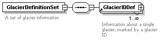 | ||
| properties |
| ||
| children | GlacierIDDef | ||
| used by |
| ||
| annotation |
|
| diagram | 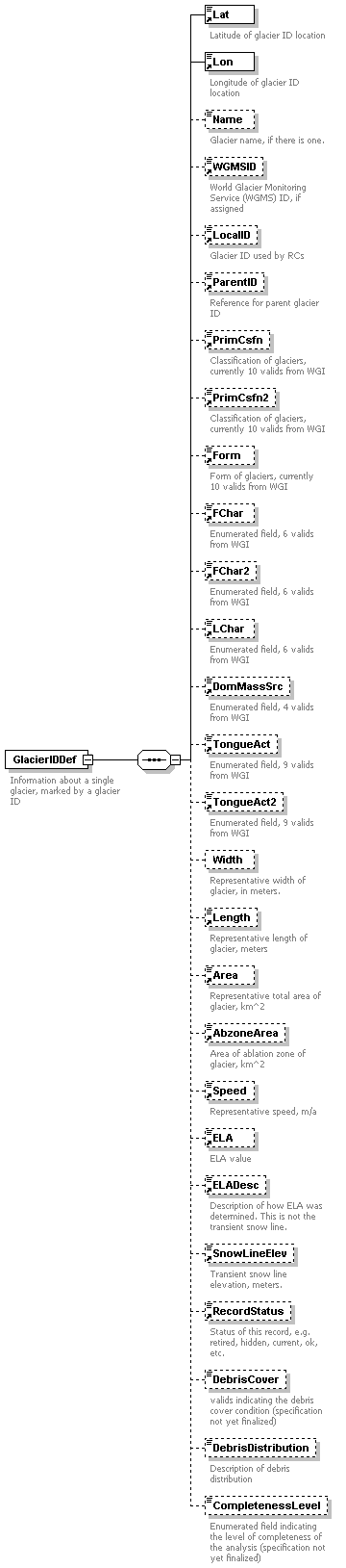 | ||
| properties |
| ||
| children | Lat Lon Name WGMSID LocalID ParentID PrimCsfn PrimCsfn2 Form FChar FChar2 LChar DomMassSrc TongueAct TongueAct2 Width Length Area AbzoneArea Speed ELA ELADesc SnowLineElev RecordStatus DebrisCover DebrisDistribution CompletenessLevel | ||
| used by |
| ||
| annotation |
|
| diagram | |||||
| type | restriction of xs:string | ||||
| properties |
| ||||
| facets |
| ||||
| annotation |
|
| diagram | 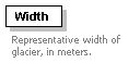 | ||
| properties |
| ||
| annotation |
|
| diagram | 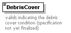 | ||||||||||||||||||||
| type | restriction of xs:integer | ||||||||||||||||||||
| properties |
| ||||||||||||||||||||
| facets |
| ||||||||||||||||||||
| annotation |
|
| diagram | 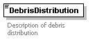 | ||||
| type | restriction of xs:string | ||||
| properties |
| ||||
| facets |
| ||||
| annotation |
|
| diagram | 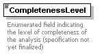 | ||||||||||||||||||||||
| type | restriction of xs:integer | ||||||||||||||||||||||
| properties |
| ||||||||||||||||||||||
| facets |
| ||||||||||||||||||||||
| annotation |
|
| diagram | 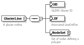 | ||
| properties |
| ||
| children | GID LDF NodeSet | ||
| used by |
| ||
| annotation |
|
| diagram | |||||||||||||||||
| type | restriction of xs:integer | ||||||||||||||||
| properties |
| ||||||||||||||||
| used by |
| ||||||||||||||||
| facets |
|
| diagram | 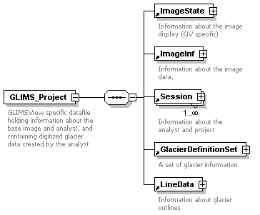 | ||
| properties |
| ||
| children | ImageState ImageInf Session GlacierDefinitionSet LineData | ||
| attributes | |||
| annotation |
|
| diagram | |||
| type | restriction of xs:integer | ||
| properties |
| ||
| used by |
| ||
| facets |
|
| diagram | |||
| type | restriction of xs:double | ||
| properties |
| ||
| used by |
| ||
| facets |
| ||
| annotation |
|
| diagram | |||
| type | restriction of xs:double | ||
| properties |
| ||
| used by |
| ||
| facets |
| ||
| annotation |
|
| diagram |  | ||||||
| type | restriction of xs:float | ||||||
| properties |
| ||||||
| used by |
| ||||||
| facets |
| ||||||
| annotation |
|
| diagram | |||
| type | restriction of xs:integer | ||
| properties |
| ||
| used by |
| ||
| facets |
| ||
| annotation |
|
| diagram | 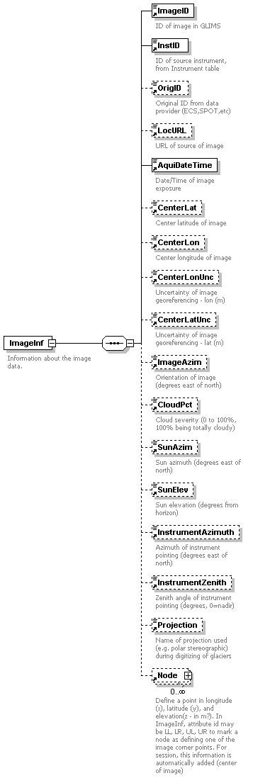 | ||
| properties |
| ||
| children | ImageID InstID OrigID LocURL AquiDateTime CenterLat CenterLon CenterLonUnc CenterLatUnc ImageAzim CloudPct SunAzim SunElev InstrumentAzimuth InstrumentZenith Projection Node | ||
| used by |
| ||
| annotation |
|
| diagram | 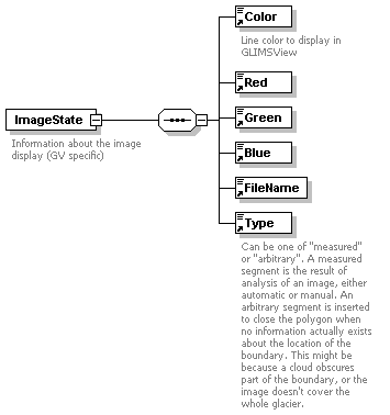 | ||||||||||||
| properties |
| ||||||||||||
| children | Color Red Green Blue FileName Type | ||||||||||||
| used by |
| ||||||||||||
| attributes |
| ||||||||||||
| annotation |
|
| diagram |  | ||
| type | restriction of xs:integer | ||
| properties |
| ||
| used by |
| ||
| facets |
| ||
| annotation |
|
| diagram | 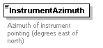 | ||||||
| type | restriction of xs:float | ||||||
| properties |
| ||||||
| used by |
| ||||||
| facets |
| ||||||
| annotation |
|
| diagram | 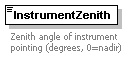 | ||||||
| type | restriction of xs:float | ||||||
| properties |
| ||||||
| used by |
| ||||||
| facets |
| ||||||
| annotation |
|
| diagram |  | ||||||||||||||||||||||||
| type | restriction of xs:integer | ||||||||||||||||||||||||
| properties |
| ||||||||||||||||||||||||
| used by |
| ||||||||||||||||||||||||
| facets |
| ||||||||||||||||||||||||
| annotation |
|
| diagram | |||||||
| type | restriction of xs:double | ||||||
| properties |
| ||||||
| used by |
| ||||||
| facets |
| ||||||
| annotation |
|
| diagram |  | ||||||||||||||||
| type | restriction of xs:integer | ||||||||||||||||
| properties |
| ||||||||||||||||
| used by |
| ||||||||||||||||
| facets |
| ||||||||||||||||
| annotation |
|
| diagram |  | ||||||||||||||||
| type | restriction of xs:integer | ||||||||||||||||
| properties |
| ||||||||||||||||
| facets |
| ||||||||||||||||
| annotation |
|
| diagram | |||
| type | restriction of xs:integer | ||
| properties |
| ||
| used by |
| ||
| facets |
| ||
| annotation |
|
| diagram |  | ||||
| type | restriction of xs:float | ||||
| properties |
| ||||
| used by |
| ||||
| facets |
| ||||
| annotation |
|
| diagram |  | ||||||||||||||||
| type | type_features | ||||||||||||||||
| properties |
| ||||||||||||||||
| used by |
| ||||||||||||||||
| facets |
| ||||||||||||||||
| annotation |
|
| diagram | 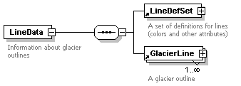 | ||
| properties |
| ||
| children | LineDefSet GlacierLine | ||
| used by |
| ||
| annotation |
|
| diagram | 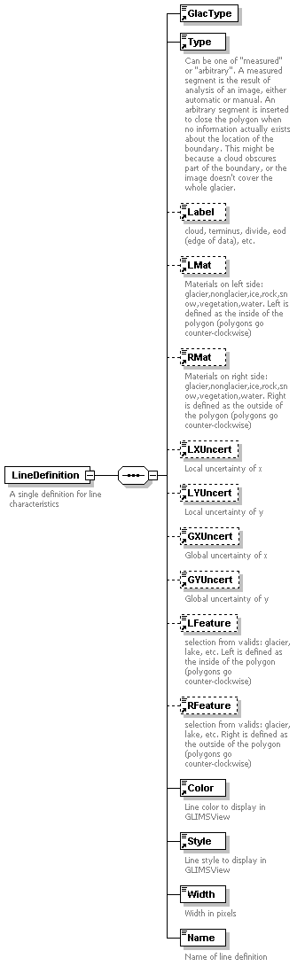 | ||
| properties |
| ||
| children | GlacType Type Label LMat RMat LXUncert LYUncert GXUncert GYUncert LFeature RFeature Color Style Width Name | ||
| used by |
| ||
| annotation |
|
| diagram | |||||||
| type | restriction of xs:integer | ||||||
| properties |
| ||||||
| facets |
| ||||||
| annotation |
|
| diagram | |||||
| type | xs:string | ||||
| properties |
| ||||
| annotation |
|
| diagram | 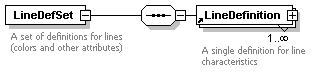 | ||
| properties |
| ||
| children | LineDefinition | ||
| used by |
| ||
| annotation |
|
| diagram | 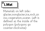 | ||||||||||||
| type | type_materials | ||||||||||||
| properties |
| ||||||||||||
| used by |
| ||||||||||||
| facets |
| ||||||||||||
| annotation |
|
| diagram | |||||
| type | restriction of xs:string | ||||
| properties |
| ||||
| used by |
| ||||
| facets |
| ||||
| annotation |
|
| diagram | |||||
| type | restriction of xs:anyURI | ||||
| properties |
| ||||
| used by |
| ||||
| facets |
| ||||
| annotation |
|
| diagram | 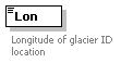 | ||||||
| type | restriction of xs:double | ||||||
| properties |
| ||||||
| used by |
| ||||||
| facets |
| ||||||
| annotation |
|
| diagram | |||
| type | restriction of xs:double | ||
| properties |
| ||
| used by |
| ||
| facets |
| ||
| annotation |
|
| diagram | |||
| type | restriction of xs:double | ||
| properties |
| ||
| used by |
| ||
| facets |
| ||
| annotation |
|
| diagram | 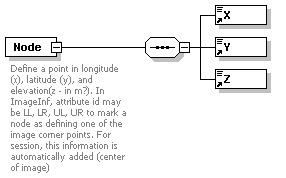 | ||||||||||||
| properties |
| ||||||||||||
| children | X Y Z | ||||||||||||
| used by |
| ||||||||||||
| attributes |
| ||||||||||||
| annotation |
|
| diagram | 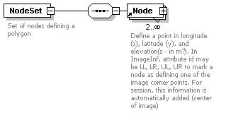 | ||
| properties |
| ||
| children | Node | ||
| used by |
| ||
| annotation |
|
| diagram | 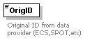 | ||||||
| type | restriction of xs:string | ||||||
| properties |
| ||||||
| used by |
| ||||||
| facets |
| ||||||
| annotation |
|
| diagram | 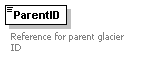 | ||||
| type | restriction of xs:string | ||||
| properties |
| ||||
| used by |
| ||||
| facets |
| ||||
| annotation |
|
| diagram | 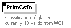 | ||||||||||||||||||||||||||
| type | restriction of xs:integer | ||||||||||||||||||||||||||
| properties |
| ||||||||||||||||||||||||||
| used by |
| ||||||||||||||||||||||||||
| facets |
| ||||||||||||||||||||||||||
| annotation |
|
| diagram |  | ||||||||||||||||||||||||||
| type | restriction of xs:integer | ||||||||||||||||||||||||||
| properties |
| ||||||||||||||||||||||||||
| used by |
| ||||||||||||||||||||||||||
| facets |
| ||||||||||||||||||||||||||
| annotation |
|
| diagram |  | ||
| type | xs:string | ||
| properties |
| ||
| used by |
| ||
| annotation |
|
| diagram |  | ||||
| type | restriction of xs:string | ||||
| properties |
| ||||
| used by |
| ||||
| facets |
| ||||
| annotation |
|
| diagram |  | ||
| type | restriction of xs:integer | ||
| properties |
| ||
| used by |
| ||
| facets |
| ||
| annotation |
|
| diagram |  | ||||
| type | restriction of xs:string | ||||
| properties |
| ||||
| used by |
| ||||
| facets |
| ||||
| annotation |
|
| diagram | |||
| type | restriction of xs:integer | ||
| properties |
| ||
| used by |
| ||
| facets |
|
| diagram |  | ||||||||||||||||
| type | type_features | ||||||||||||||||
| properties |
| ||||||||||||||||
| used by |
| ||||||||||||||||
| facets |
| ||||||||||||||||
| annotation |
|
| diagram |  | ||||||||||||
| type | type_materials | ||||||||||||
| properties |
| ||||||||||||
| used by |
| ||||||||||||
| facets |
| ||||||||||||
| annotation |
|
| diagram | 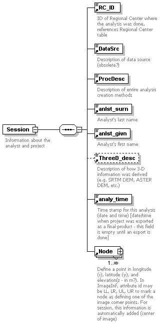 | ||
| properties |
| ||
| children | RC_ID DataSrc ProcDesc anlst_surn anlst_givn ThreeD_desc analy_time Node | ||
| used by |
| ||
| annotation |
|
| diagram |  | ||
| type | restriction of xs:float | ||
| properties |
| ||
| used by |
| ||
| facets |
| ||
| annotation |
|
| diagram | |||||
| type | restriction of xs:float | ||||
| properties |
| ||||
| used by |
| ||||
| facets |
| ||||
| annotation |
|
| diagram |  | ||||||||
| type | restriction of xs:integer | ||||||||
| properties |
| ||||||||
| used by |
| ||||||||
| facets |
| ||||||||
| annotation |
|
| diagram |  | ||||||
| type | restriction of xs:float | ||||||
| properties |
| ||||||
| used by |
| ||||||
| facets |
| ||||||
| annotation |
|
| diagram |  | ||||||
| type | restriction of xs:float | ||||||
| properties |
| ||||||
| used by |
| ||||||
| facets |
| ||||||
| annotation |
|
| diagram |  | ||
| type | xs:string | ||
| properties |
| ||
| used by |
| ||
| annotation |
|
| diagram |  | ||||||||||||||||||||||
| type | restriction of xs:integer | ||||||||||||||||||||||
| properties |
| ||||||||||||||||||||||
| used by |
| ||||||||||||||||||||||
| facets |
| ||||||||||||||||||||||
| annotation |
|
| diagram |  | ||||||||||||||||||||||
| type | restriction of xs:integer | ||||||||||||||||||||||
| properties |
| ||||||||||||||||||||||
| used by |
| ||||||||||||||||||||||
| facets |
| ||||||||||||||||||||||
| annotation |
|
| diagram |  | ||||||
| type | restriction of xs:integer | ||||||
| properties |
| ||||||
| used by |
| ||||||
| facets |
| ||||||
| annotation |
|
| diagram |  | ||||
| type | restriction of xs:string | ||||
| properties |
| ||||
| used by |
| ||||
| facets |
| ||||
| annotation |
|
| diagram | |||
| type | restriction of xs:double | ||
| properties |
| ||
| used by |
| ||
| facets |
|
| diagram | |||
| type | restriction of xs:double | ||
| properties |
| ||
| used by |
| ||
| facets |
|
| diagram | |||
| type | restriction of xs:double | ||
| properties |
| ||
| used by |
| ||
| facets |
|
| type | restriction of xs:integer | ||||||||||||||||
| properties |
| ||||||||||||||||
| used by |
| ||||||||||||||||
| facets |
|
| type | restriction of xs:integer | ||||||||||||
| properties |
| ||||||||||||
| used by |
| ||||||||||||
| facets |
| ||||||||||||
| annotation |
|